
The Ozarks are famous for drawing visitors who want to enjoy the colors of autumn, as the deciduous trees transition to their palette of red, orange, and gold---sandwiched between the vivid green of cedar and pine. However, there is a DIFFERENT kind of color you can observe in the Ozarks on the Saturday before Thanksgiving---that is the color of hundreds of runners and walkers, flowing like a river, as they ramble past the White River, in Cotter, Arkansas.

This phenomena started ten years ago when avid runner Laurie Kasinger (shown in this collage talking on her cell phone) wanted to turn her love of running, into something that would help others, not just herself. She talked to her church pastor about it, and with his help, support was garnered from area churches, to start what is now called the White River Marathon (
www.whiterivermarathon.com ). The project chosen to help others, is a part of a Community Development Program, in Katito, Kenya, under the auspices of World Vision (
www.worldvision.org ). It was this event ten years ago, that motivated me to not only participate in the 5K, but also to start sponsoring a child in Katito, Kenya, through World Vision. Likewise, dozens of others have become "enlightened" as to how they can help a child on another continent, and are also sponsoring children in Katito. Several residents from the Mountain Home area have made the trip to Katito to see for themselves, how the World Vision Community Development Program has improved lives for residents of that village. I am thankful I have been able to see a little girl in Kenya grow from a preschooler, to a teenager, these last ten years, through the photos and updates on her, that I receive regularly from World Vision. Likewise, I am thankful that I have been able to participate in the 5K division of the White River Marathon for Kenya these last ten years! Over that time period, some traditions have developed involving the race, including having my photo made with the Johnsons! (lower left corner of collage). In addition, I remember taking a photo of Laurie at that first race, and being impressed with her gentle spirit. I got to know her better later, as she was a participant in a healthy living program I work with locally, called First Place 4 Health (
www.FirstPlace4Health.com ).

As you can imagine, I have a nice collection of tee shirts from the ten events, and the red color of the 2013 shirt, will brighten my closet for sure!

The thermometer was registering in the low forties, at the 7 am race starting time, which might account for the shivering appearance of some of these marathoners at the starting line!

Runners had the option of keeping on their warm outer gear as long as possible, then putting it into a plastic bag with their name on it, piled up at the starting line. These "drop bags" were then delivered to the finish line, for them to retrieve their outer garments, once they finished the race.

Fortunately, the precipitation that happened overnight had dissipated by race time, which was a blessing!

A photographer was there to take photos of people as they crossed the finish line (
www.podiumimages.com ), but I wanted to get my own photo of this pretty First Place 4 Health alum, as she sprinted across the finish line!

Something new this year was that we each had a computer timing chip attached to our shoe lace (right photo), so it was important that we stepped on the blue mats at the finish line (left photo), to "complete the circuit". A volunteer was waiting for us at the end, to cut off the "high-tech hardware" !

As the title of the event implies, the route follows the banks of the White River for much of the time (left photo), so the scenery is gorgeous. Also, there are trash containers, and portable toilets along the way, to make sure it stays that way!

At the finish line, there is an abundance of bottled water, sports beverages, GU, bananas, donuts, and bagels, to replenish the tried, hungry, and thirsty runners! In addition, area Licensed Massage Therapists, volunteer their services, and set up their tables at the Cotter School finish line area, to soothe the aching muscles of those brave souls who complete the marathon.

Since the finish line is about one mile from the starting line (where participants park their cars), local churches generously supplied vans to transport runners back to the race headquarters at the Cotter School.

As always, an ambulance from the local hospital was on site to assist with any emergencies.

When a runner/walker returns to the finish line, the bottom part of their race number is torn off, then placed on these boards, in order to keep track of participants' name and age group. Having assisted with 5K runs back in the 1970's, I can assure you, race tally procedures have been greatly streamlined in the day of cyberspace computer technology!

I took this photo of Dr. Hilvert giving out a prize, because the female he is presenting it to, is the one who won first place in my age category. When I went over afterwards to congratulate her, she told me she was from out of state (in the Ozarks, we just say someone like that is from "OFF"), and she was one of numerous folks from "OFF", who return year after year, because they like the location!! We want EVERYONE, whether they are locals, or from "OFF", to feel welcome at the White River Marathon for Kenya!

I was DELIGHTED to win second place in my age group for the 5K, and received my first medal (some would say, it is about time, since I have made TEN attempts!) I especially liked the medal because when you hold it up to the light, the blue sky and green hills are translucent, giving the appearance of a stained glass window! Even though the ribbon says "second place", if you consider the lady who beat me was not from Arkansas, I could say I was in "first place" of the Arkansas females in my age category!

It was so great to see kids participating in the event, and enjoying the excitement of winning a medal, or assisting at the awards ceremony!

In case a runner realized at the last minute that they needed a particular running accessory, this vendor was there to supply their needs!

Also available at the finish line was a variety of homemade soups/chili, fruit, pizza, and breakfast sandwiches. Thanks to all the volunteers/food establishment owners who supplied and served these delicious items!

Hopefully, seeing what a great event this is, has made you want to put it on your calendar for next year! As the photo shows, the White River Marathon for Kenya is a Boston Marathon Qualifier, it has the flattest and fastest course in Arkansas, and it is scheduled for November 22, 2014!! BE THERE!!

When I saw all the feet at the event today, I was reminded of the verse from Romans 10:15----"How can people tell the Good News if no one sends them? As Scripture says, 'How beautiful are the feet of the messengers who announce the Good News' ." In the town of Katito, Kenya, more people are hearing that Good News, thanks to the White River Marathon for Kenya! This Good News will bring all of us "MILES OF SMILES"!!! Tricia
 The pointed black peak in this photo is called Black Butte, and is easily viewed from my son's house in Mt. Shasta, California. All my loved ones who live in that town have climbed to the summit of Black Butte, and I have made it my goal to be included in the "club" that can say they have made it to the summit of Black Butte! The one time my son and I were going to attempt it, the U.S. Forest Service told us the road to access it was closed, due to snow coverage. Since then, I have been studying up on it, and learned that the best time to climb it, is from mid-May to mid-November. Books say it is a 5.2 mile round trip, that most people complete as a "half day" outing. Its summit is recorded as being at 6,235 feet. While brainstorming how I could fly out to California to climb it, it occurred to me that I needed to test my stamina for climbing another "pointed peak", that was in my home state of Arkansas. It did not seem right to travel to another state to climb a mountain, when there was one right in my own "back yard" that I have driven past all my life when making trips to Little Rock, yet never climbed!
 That realization got me to "studying" Pinnacle Mountain in central Arkansas. This is a photo of Pinnacle, taken from the deck of my friends' home, many miles away from Pinnacle, in Roland, Arkansas. The cone shaped peak of Pinnacle Mountain has been an Arkansas landmark for generations. Rising 756 feet from the adjacent flood plains, Pinnacle's rocky peak reaches an elevation of 1,011 feet above sea level.
 After several phone calls to the Pinnacle Mountain State Park, and talking to lots of people who had already climbed the mountain, I decided it was something I could do, but I would need to find a fellow hiker to go with me, as it is generally recommended that one not hike alone. That would mean alot of preplanning and coordinating calendar schedules, travel time, etc., etc.
 It crossed my mind that the view that I would see from the summit of Pinnacle Mountain would probably not be that much different from the view that one could see from the easily accessible deck off the back of the Visitor Center! Since I happened to be in the area of the State Park for another event, I thought the least I could do in preparation for my future "summit attempt" was check out the trail entrance!
 I saw some visitors talking about taking the trail from the visitor's center, that eventually connects to the trail to the summit. That spurred on my interest!
 The Visitor Center personnel told me another option would be to simply drive to the West Summit Picnic Area, which would greatly shorten the hike. Even though I was reluctant since I did not have a hiking companion, I thought I could at least check out the area for future reference. What I found when I arrived there was that it was OVERFLOWING with people! I could hardly find a parking space. It was a beautiful sunny, Sunday afternoon, and it seemed that all of Central Arkansas, had converged on the site!
 After seeing that I would definitely NOT be alone on the trail, I thought I could at least look at the first part of it, and get a "feel" for what it would be like to hike to the summit.
 The signs are necessary because the trail is not without its hazards, particularly at the higher elevations.
 I was used to carrying lots of water after doing desert hiking in Sedona, Arizona, with Road Scholar ( www.roadscholar.org ) earlier in the year, so I had my handy-dandy water bottle carrier with me, as well!
 Various geological features along the trail kept grabbing my attention, making me want to keep on exploring further and further up !
 Some of the trail surfaces have been covered in flat stones, such as the one shown here.
 Some of the trail is divided into broad steps, as shown here. Seeing women climbing the trail with skirts on reminded me of a story that my son told me on his first attempt to summit Mt. Shasta, as part of a Wilderness Medicine Continuing Education program. Their leader told them, that whenever they got to thinking it was too difficult for their young, athletic, well-equipped, gear-abundant, Northface-clad bodies to do, to keep in mind that one hundred years ago, the mountain had been summited by some women in skirts down to their ankles!
 As I proceeded upward, there were even benches where I could stop and rest, looking out over the beautiful Arkansas River Valley below!
 This dad is being cautious with his boys, making sure he had a hold on each boy, while simultaneously checking out where the heck he was on the trail!
 I read this sign that said the trail splits into one that is easier versus one that is difficult and directly over the boulders. That was a "no-brainer"! I was going to choose the easier trail!
 Unfortunately, however, somehow I missed the marker that was the dividing point for the easier vs. harder trail, and found myself crawling over boulders, and searching for the trail markers that were painted on them to show which general direction to scramble to next!
 But with perseverance, I made it eventually to where the two paths merged, and followed the ridge line to the summit.
 Pinnacle Mountain is part of the "Maumelle Mountains", which were named by the early French explorers. It seems the peaks reminded them of female mammary glands, or maumelle!
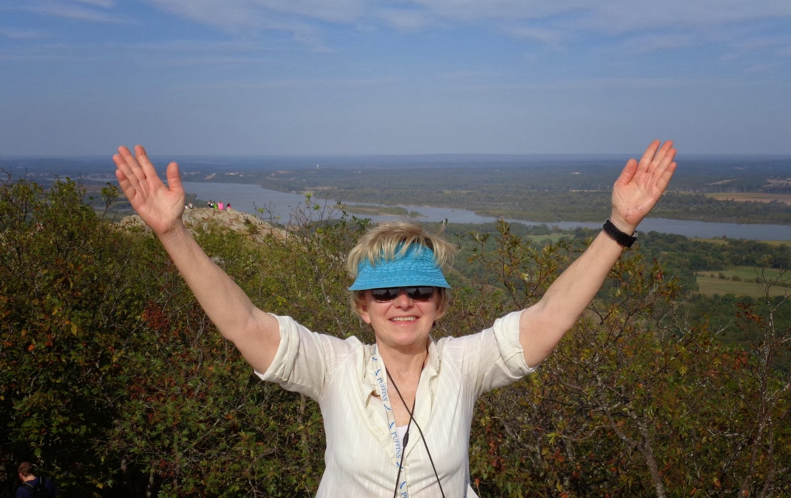 I am including this photo of me giving the victory symbol of praise to God at the summit, because I was SO PROUD of myself for accomplishing it! It was just a matter of taking that first step, and then putting one foot in front of the other. I want to encourage others to get out there and enjoy the beautiful outdoors God has created for us---his great classroom!
 I had been observing this young lady exploring the ridge trail with her family, thoroughly enjoying the thrill of accomplishment and the beauty around her. Psalm 36:5 says "Your love, O LORD, reaches to the heavens, your faithfulness to the skies. Your righteousness is like the mighty mountains, ....how priceless is your unfailing love." Another thing that is priceless is the wonderful park system we have in our country. Many of these parks are promoting what is called a "First Day Hike" on January 1, 2014. So check out a park near you so you can get the year off to a great start by enjoying the outdoors. In Arkansas, just log on to www.ArkansasStateParks.com , to find out more. I guarantee, it will give you "Miles of Smiles"!! Tricia


 Our group huddled together for a quick photo, after we finished our lunch, and proceeded to march off the remaining three miles of our hike. The temperature was perfect for hiking at a steady pace, but when we stopped for lunch, we found ourselves putting those coats back on, that we had packed away earlier in the hike! Our pre-trip guidelines had advised us to dress in layers, and it was good advice! Even though I carried a rain slicker in my back pack all week long, I am VERY THANKFUL I never needed to use it!! PTL!!


