
One of the most beautiful areas I have ever visited (not including the lovely Ozark Mountains where I live), is the Columbia River Gorge, between the states of Oregon and Washington, in the Pacific Northwest. It is not surprising that the area has been designated by the Department of the Interior as a National Scenic Area. I took this photograph from the Women's Forum State Park, near Portland, Oregon. The dome-roofed building seen on the distant bluff on the right, is called the Vista House at Crown Point State Scenic View Point. The Vista House (which was built soon after the scenic highway was dedicated in 1916) gives the visitor a 30-mile panoramic view of the Columbia River Gorge, from 733 feet above sea level. It is truly a majestic experience, and there is no charge to visit the Vista House!

There are 11 waterfalls along the Columbia Gorge Scenic Highway. The highest waterfall along the drive is 620-foot-tall Moltnomah Falls, shown in this photograph. There is a (free!) Interpretive Center at the base of the falls, that has displays of the biology, geology and history of the area. Also located at the base, is a historic and picturesque restaurant, which gives you great views of the waterfall, as you dine. On one of my visits to dine there, it happened to be my birthday, and celebrating life in such a gorgeous location, made it a memorable birthday, indeed.

The Columbia River Gorge intersects with parts of the Historic Oregon Trail, with appropriate historical markers placed along the route, such as this one. My husband and I actually climbed to the top of Beacon Rock, mentioned in the marker, and seen in the distant horizon of this photograph. Although it is quite steep, no technical climbing equipment was needed for our ascent, as steps were constructed decades ago, to provide access to the summit of this strategic location along the river.

The section of the Columbia River shown in this photograph serves as the boundary line between northern Oregon(left side) and southern Washington (right side).

The bridge shown in this photograph is located in the town of Cascade Locks, Oregon. If you walk across this bridge, you can say, "I hiked the Pacific Crest Trail between Oregon and Washington" because the bridge is the "the link" that connects those two sections of the 2,650 mile pedestrian "path" between Mexico and Canada, that has been designated as the Pacific Crest National Scenic Trail. Of course, I had to do that, and now have the hiking medallion on my walking stick as "proof"!!

I took the Columbia Gorge Stern wheeler cruise on my last visit, and was able to observe examples of age-old fishing techniques, still being practiced. However, such practices are not allowed for the general public. Rather, there are various treaties that allow Native Americans to fish in waters, that are off limits to non-Native Americans.

The snow-covered mountain shown in this photograph, is Mt. Hood. Even though the photo was taken in June, there is still considerable snow that has not melted.

Long before I was ever able to visit this area in person, I had seen a television program about this being the "mecca" for wind surfing; so I was delighted to see so many windsurfers out enjoying their sport, on my last visit to the section of the Columbia River Gorge, that is near the town of Hood River, Oregon.

There is such a prevalence of windsurfers here, that they have formed the Columbia Gorge Windsurfing Association, with a very helpful website, located at
www.gorgewindsurfing.org .

In addition to windsurfing, one can still enjoy good "old-fashioned sailing", with rentals and instruction available from
www.hoodriverwaterplay.com . Years ago, I took a two-day sailing certification course from the Annapolis Sailing School (
www.annapolissailing.com ). Alas, however, my little Annapolis Sailing Certificate was not sufficient for my brother-in-law to trust me alone at the helm of his 42-foot sail boat
Cirrus, on our sailing adventures along the New England coast area!

With the cold waters from snow melt running into the Columbia River Gorge, it is not surprising that all the participants were wearing full wetsuits, even on a hot day in June!

This photograph shows a "long shot" of a kite boarder, with his kite seen hundreds of feet above him, near the mountaintop.

As with windsurfers, the town of Hood River is also a mecca for kite boarding. ( But, lest you think that you have to be a "macho man" to find activities of interest in Hood River, you will see by going to
www.hoodriver.org there are NUMEROUS shops, restaurants, orchards, and wineries to keep you entertained, without having to put on a wet suit! )

Since the kite boarder is actually "flying" at some points of his/her experience, it is not unusual for a kite boarder to start in Oregon, but end up a few minutes later in Washington!

Because kite boarding involves a greater degree of risk, there are actually strict rules that govern where kite boarders can practice their sport. These rules, as well as numerous other types of helpful information, can be found at
www.NWKite.com .

An ever-present risk for kite boarders is that the lines connecting YOUR harness to you, get crossed with the lines of ANOTHER kite boarder, or structure, such as a bridge. This photograph illustrates just such a mishap.

However, while spending the day watching the kite boarders, and listening to them talk about the experience afterwards, it was clear that this sport was what put the "wind in their sails", when it came to adrenalin-seeking activities. They craved the feel of the wind tugging them upward, followed by the rush of skipping across the water.

Seeing the many ways that the rivers of the Columbia Gorge area provide recreation, happiness, entertainment, irrigation, transportation, and livelihood, I was reminded of John 7:37 that says "If a person believes in me, Rivers of Living Water will flow out of his heart." Now THAT is a river that will sustain you FOREVER, and give you MILES OF SMILES! Tricia

 One of the most beautiful areas I have ever visited (not including the lovely Ozark Mountains where I live), is the Columbia River Gorge, between the states of Oregon and Washington, in the Pacific Northwest. It is not surprising that the area has been designated by the Department of the Interior as a National Scenic Area. I took this photograph from the Women's Forum State Park, near Portland, Oregon. The dome-roofed building seen on the distant bluff on the right, is called the Vista House at Crown Point State Scenic View Point. The Vista House (which was built soon after the scenic highway was dedicated in 1916) gives the visitor a 30-mile panoramic view of the Columbia River Gorge, from 733 feet above sea level. It is truly a majestic experience, and there is no charge to visit the Vista House!
  There are 11 waterfalls along the Columbia Gorge Scenic Highway. The highest waterfall along the drive is 620-foot-tall Moltnomah Falls, shown in this photograph. There is a (free!) Interpretive Center at the base of the falls, that has displays of the biology, geology and history of the area. Also located at the base, is a historic and picturesque restaurant, which gives you great views of the waterfall, as you dine. On one of my visits to dine there, it happened to be my birthday, and celebrating life in such a gorgeous location, made it a memorable birthday, indeed.
 The Columbia River Gorge intersects with parts of the Historic Oregon Trail, with appropriate historical markers placed along the route, such as this one. My husband and I actually climbed to the top of Beacon Rock, mentioned in the marker, and seen in the distant horizon of this photograph. Although it is quite steep, no technical climbing equipment was needed for our ascent, as steps were constructed decades ago, to provide access to the summit of this strategic location along the river.
  The bridge shown in this photograph is located in the town of Cascade Locks, Oregon. If you walk across this bridge, you can say, "I hiked the Pacific Crest Trail between Oregon and Washington" because the bridge is the "the link" that connects those two sections of the 2,650 mile pedestrian "path" between Mexico and Canada, that has been designated as the Pacific Crest National Scenic Trail. Of course, I had to do that, and now have the hiking medallion on my walking stick as "proof"!!
 I took the Columbia Gorge Stern wheeler cruise on my last visit, and was able to observe examples of age-old fishing techniques, still being practiced. However, such practices are not allowed for the general public. Rather, there are various treaties that allow Native Americans to fish in waters, that are off limits to non-Native Americans.
 The snow-covered mountain shown in this photograph, is Mt. Hood. Even though the photo was taken in June, there is still considerable snow that has not melted.
  Long before I was ever able to visit this area in person, I had seen a television program about this being the "mecca" for wind surfing; so I was delighted to see so many windsurfers out enjoying their sport, on my last visit to the section of the Columbia River Gorge, that is near the town of Hood River, Oregon.
 There is such a prevalence of windsurfers here, that they have formed the Columbia Gorge Windsurfing Association, with a very helpful website, located at www.gorgewindsurfing.org .
 In addition to windsurfing, one can still enjoy good "old-fashioned sailing", with rentals and instruction available from www.hoodriverwaterplay.com . Years ago, I took a two-day sailing certification course from the Annapolis Sailing School ( www.annapolissailing.com ). Alas, however, my little Annapolis Sailing Certificate was not sufficient for my brother-in-law to trust me alone at the helm of his 42-foot sail boat Cirrus, on our sailing adventures along the New England coast area!
 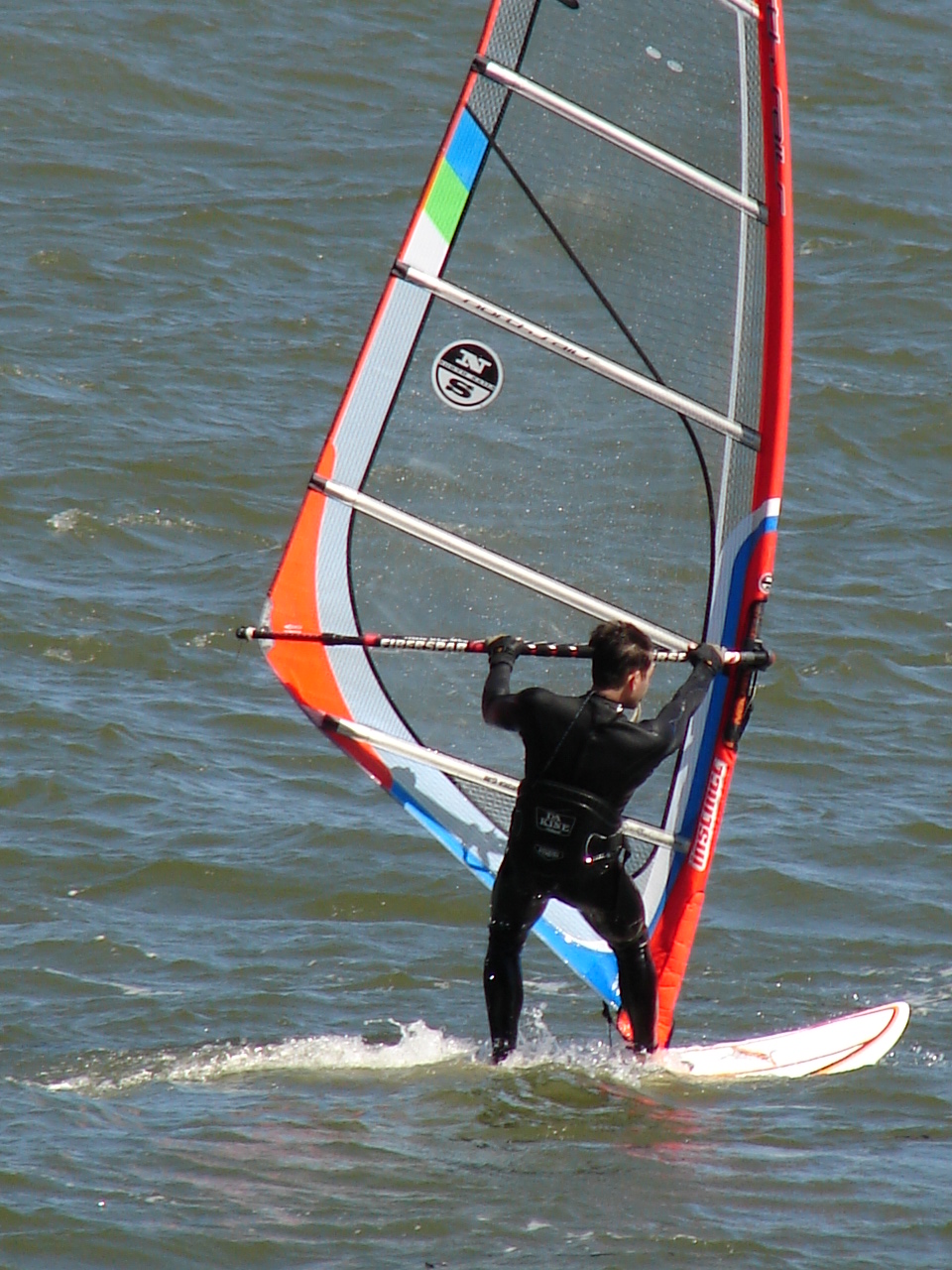 With the cold waters from snow melt running into the Columbia River Gorge, it is not surprising that all the participants were wearing full wetsuits, even on a hot day in June!
 This photograph shows a "long shot" of a kite boarder, with his kite seen hundreds of feet above him, near the mountaintop.
 As with windsurfers, the town of Hood River is also a mecca for kite boarding. ( But, lest you think that you have to be a "macho man" to find activities of interest in Hood River, you will see by going to www.hoodriver.org there are NUMEROUS shops, restaurants, orchards, and wineries to keep you entertained, without having to put on a wet suit! )
 Since the kite boarder is actually "flying" at some points of his/her experience, it is not unusual for a kite boarder to start in Oregon, but end up a few minutes later in Washington!
 Because kite boarding involves a greater degree of risk, there are actually strict rules that govern where kite boarders can practice their sport. These rules, as well as numerous other types of helpful information, can be found at www.NWKite.com .
 An ever-present risk for kite boarders is that the lines connecting YOUR harness to you, get crossed with the lines of ANOTHER kite boarder, or structure, such as a bridge. This photograph illustrates just such a mishap.
 However, while spending the day watching the kite boarders, and listening to them talk about the experience afterwards, it was clear that this sport was what put the "wind in their sails", when it came to adrenalin-seeking activities. They craved the feel of the wind tugging them upward, followed by the rush of skipping across the water.


