Showing posts with label Table Rock Lake. Show all posts

Thursday, September 12, 2024

RUN THE ROCK EXPEDITION!

Just making it to the area where the race was to begin, was enough of an accomplishment for me to cause me to raise my hands in gratitude!  I live about three hours away from where the race was held, so that meant traveling to the area the night before, and staying in a motel.  (The event has to start very early in the morning, so that the course can be cleared in time for the regularly scheduled Lost Canyon Cave Tours, via golf carts, to proceed.)  I had driven to Top of the Rock about one month prior, in order to scope out the gated entrance to the expansive property.  I knew there was a normally a  fee for non-hotel guests to go through the gates, so I had contacted the race officials (fitness@basspro.com) in advance to ask if I still paid the gate fee, since I was a race participant.  I was told there would not be a fee for me to enter, and that volunteers would be at the entrance, to assure my admission onto the campus.  When I turned into the entrance area, it was completely dark, and instead of me going through the gated entrance, there was a person holding a flashlight, directing me to turn right, BEFORE the entrance gate.  So I followed several other cars down a dark road into, what seemed like a black hole, and kept going in the direction of people waving flashlights, until there were no cars in front of me, as they had all pulled off to park.  So, I too, pulled off to park, in what appeared to be an unpaved field, and got out of my car.  Still with no clue as to where I was, I followed a couple in front of me farther into the darkness, and asked if they knew where the registration packet pick up was supposed to be.  They said they did not know either, so I started walking in the darkness with them, in a direction where we heard voices. 


After walking a long ways in the darkness, we saw a line of people and joined in their line.  I asked one of them if this was the late packet pickup line, and they said, they did not know, but hoped that it was! This pre-dawn experience was referred to "late packet pick up", because registrants were told to pick up their packets on Thursday, before the Saturday race.  However, that would have involved a two-night motel stay for me, so that is why I opted to pick up my packet on the morning of the race. 
``
When it was my turn to be at the computer checkin, I was delighted that they actually had my name on their list, and they gave me my race "bib", which had my number on it and the size teeshirt I had requested.  The race director, who I was introduced to later as Melissa Bondy, pointed me to farther down the table to receive my tee shirt, vinyl Bass Pro bag, and safety pins to affix my race number to my teeshirt. 


The gals giving out the bags and teeshirts assured me safety pins were inside the bags, but having once been in a 5K that ran out of safety pins, I did not leave the area, until I was sure I had what I needed.  The shirts for the three mile were lilac, and the shirts for the six mile event were blue.  The photo also shows the Bass Pro bags each registrant was given.  With it still being dark, and still being completely disoriented as to where I was, I followed a group of people who said they were going in the direction of the starting line. ( I did not want to use up my energy walking the long way back into "GOK"-where to try to find where I had parked my car, to put my bag into my car, so I had assumed I would be carrying that bag all during the 3-mile event.)
So, when I found the starting line, I took a few photos, then proceeded to find a rock to sit on to wait for the event to begin.  (That is the photo you see that introduces this blog)  After it got to be daylight, I spotted Brooke, who had been introduced as the social media guru for the Bass Pro Fitness Series, and I asked if I could get her photo. 
She proceeded to take my photo, and told me to be sure my race  number was showing for the photo.  I did not realize it at the time, but the computer timing chip was affixed to the back of the race bib.  For the 5K events I have participated in before this time, we were given the computer timing chips in our race packet, which we then affixed by tying them onto our shoes.  Then we were asked to remove the chips from our shoes after the event, and turn them back into the race officials.  


The runners in the 6 mile part of the event were scheduled to start at 7 am, whereas the runners in the 3 mile part were scheduled for 7:15 am.  The photo below shows the 6 milers lining up, with the sun just barely peeping over the mountain tops.  All of the pre-race information had alerted the participants that the course was VERY hilly, steep, and wet in parts, so they should not be expecting any outstanding "speed" times.  Rather, the emphasis was on enjoying the beautiful scenery. 

Even though this was not a "qualifier race" for something like the Boston Marathon, the professional timers were there with their specialized equipment that records each participants time as they cross the activated equipment at the beginning and the end of the race.  We were told in advance that everyone had to be off the course in ninety minutes, so the afore-mentioned tourist golf cart tours could begin. 
The photo below was on Facebook page of the Bass Pro Fitness Series.  I found myself in the photo---the one in the yellow, long sleeved jacket.  (I had realized that I could flatten the Bass Pro bag I had been given at the start of the race, and stick it in the back of my tights, so I could have a "hands free" walk along the course.)  

Notice this gentleman carrying a youngster in a backpack, had also flattened his Bass Pro bag, and put it away, behind his 33 race number.  I was huffing and puffing going up this long hill, so I had great admiration for this man carrying so much additional poundage on his back, as he also walked up the hill!


When you go up a hill in the Ozarks, you can be sure that you will eventually be going down, and this hill was so steep, it needed a warning sign!

The race director told us when she was greeting the crowd before the event started, that heavy rains had washed out the paved golf cart road along part of the course, so we would be crossing gravel terrain for a bit, so I was not surprised when the pavement ended. 

However, what DID surprise me, was making my way down an improvised path in the woods, to reach the lower level of the gravel road.  I am guessing that this mother, who had been pushing a child in a stroller for the 3 mile event, did not know an off-trail passage was part of the deal!  Fortunately, several volunteers and other walkers, assisted her in carrying the stroller down to the next level. 
Top of the Rock started a "Nature at Night" golf cart tour last year, that expands the operating hours of the golf cart tour through the Lost Cave Canyon.   To enhance the experience, they have added some sculptures to the course, that are quite dramatic, when lighted at night.  The bird in flight (shown below) is one of those features. 
The space across the canyon is made accessible, first by a trail that leads down to a switchback, that will take one to the entrance of the bridge over the canyon.
Photo below shows runners exiting the Amish-built covered bridge.  (If you visit www.BigCedar.com , you can learn about additional Amish-built structures within their nature preserve)

Below a walker is approaching the entrance to the cave, that sits at the bottom of Lost Canyon.  The volunteer standing at the door is alerting the man to slow down to let his eyes adjust to the darkness, and let his feet get prepared for the slick, wet surface he will be going over. 

This is the photo of the four-story tall waterfall inside the cave.   The entire acreage is a part of the Top of the Rock Ozarks Heritage Preserve.  It is a privately-owned operation by Johnny Morris, that is open to the public, and has an entrance fee. 
The blue lighting makes for a romantic moment for this couple to enjoy, as they pause for a selfie photo at the waterfall. 

I was told one cannot get lost inside this cave, so I kept putting one foot carefully in front of the other, in the dimly lit space, until I could see the proverbial "light at the end of the tunnel"!
When folks exited the cave, there were volunteers there to provide some water for hydration.  I had not been carrying a water bottle, so I was ready to take them up on their offer!
One of the incredibly scenic areas along the course is called Horseshoe Falls, and it has two different steel bridges spanning its sides, above some gushing waterfalls. 
Bass Pro retail shops are famous for having dozens of deer mounts scattered throughout their retail space, so possibly it is a Johnny Morris requirement, that there is a tribute to this antlered creature.  The one at Lost Canyon Cave Trail is humongous, and abides in front of the waterfall, with its legs hiked up, as though it has just landed from a steep jump.  I have seen photos of what it looks like when it is fully lighted at night, and it presents a very stunning scene! ( see www.explorebranson.com for more information)
There is a constant flow of water onto the pavement at this point, so a portable metal bridge provides a safer alternative to those who do not want to wade through the water. 
The photo below of a girl inside the covered bridge, gives you a good look at the carefully-engineered beams that make up the structure.  As you can see there are lights that line its trusses, so this must look like a tunnel of "X" lights on the nighttime tour.  (By the way, if you search on You Tube, there are videos that visitors have taken of the night tour, as they rode through on their golf carts, enabling you to have a preview of the experience.) 

Can you see the figure below of a lady passing in front of the waterfall?  That provides some dimension/scale to how gigantic this canine is, depicted howling at the moon (represented by globe on the hillside).  Again, this would be much more dramatic when it is lit up at night, and the globe does indeed, look like the moon. 
There was an official race photographer stationed near the last waterfall; and, since most of the other participants had passed this point much earlier, he had time to take a photo of my happy heart gesture with my cell phone. 
At the beginning of the race, the director encouraged the runners to take the time to walk out onto the overlook, although it was not a requirement for getting in the required mileage.   Of course, I was curious to see what I could view at the end of the overlook, and wanted to get a photo of the "bird" that guarded its entrance.  The poles in front of the walkway overlook, indicate one is NOT supposed to drive their golf cart onto the overlook. 

The Top of the Rock Nature Preserve is located adjacent to Table Rock Lake, near Ridgedale, Missouri.  Seeing this feature of stones along the trail, that looked liked table tops stacked on top of each other, it is easy to see where the name "Table Rock" originates!

This is a photo of me, holding the sign, indicating I had finished the event.  It was a photo I saw in September of 2023 on social media, of a runner holding the same sign, that first alerted me to a fitness event that takes place within a few miles of Branson, Missouri, and just a few hours of where I live; and, it motivated me to strive toward getting in better shape physically.    Perhaps this photo will also motivate someone, to start a training regime that will enable them to participate in the 2025 Run the Rock!  (More details of my training regime the last year is provided in blog dated, September 7, 2024, entitled "Grace for the Race Expedition")

The entrance sign at Top of the Rock is beside a bronze statue of a Native American lifting up a buffalo skull.  It can symbolize many things, one of them being an offering of thanksgiving for the resources the  buffalo provided to the Native American tribes.  It can also represent the resilience and survival of the Native American tribes.  Leviticus 7:30 also talks about holding one's sacrifice in your hands and lifting it up as a special gift to the LORD.  The sacrifice of Jesus on the cross is another example.  Romans 12:1 says in part, "....in view of God's mercy, offer your body as a living sacrifice, holy and pleasing to God---this is your true and proper worship."  When one sacrifices their own comfort and desires, so they can make their body more fit to serve God, it is an act of worship.  When that is the motivation for my commitment to keep active, it gives me "MILES OF SMILES"!  Tricia


Monday, May 1, 2023

BRANSON PINK JEEP EXPEDITION!

When I saw this photo on the 2023 Official Branson Vacation Guide, I knew immediately it was something I wanted to do!  I first heard about pink jeep tours when I was in Las Vegas, and participated in the tour they offer to Hoover Dam.  (See "Hoover Dam Expedition", February 20, 2012, in the archives of this blog)

 The opportunity came to reality when I attended the Select Traveler Conference, at Chateau on the Lake,  in Branson, Missouri, on my birthday.  I can tell you from first-hand experience, that getting to go on a pink jeep adventure, makes for a fantastic birthday outing!
The Branson company brought all seven of their pink jeeps to the Chateau, to pick up our very large group.  Normally, guests go to the Pink Jeep office at 3310 West Highway 76, to start their tour. However, since you can see our hotel in the background in photo above, it is apparent, exceptions can be made!
I was so thankful to get to sit in the front seat--that is me pointing to the door sign.  I also took a photo of our driver, Barry, and my fellow passengers in the back.  The clear vinyl curtains were in use on the day of our tour, since it was still nippy outside.  In warmer weather, the vehicle will be more "open air", so guests can enjoy some Ozark Mountain "wind therapy" on their adventure. 
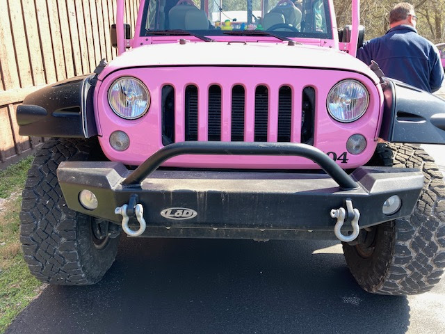
Did you know there are several legends as to the origin of the distinctive seven slots in a jeep grill?  Several of them  are listed on the official Jeep website, but the one I have heard for decades (I used to own a jeep) is that the Jeep was the first vehicle to drive on all seven continents before any other vehicle.  Remember---Jeep was originally a military vehicle. 

As we left the Chateau, I felt like a celebrity, because a videographer was filming this "parade" of pink jeeps, as we drove down the beautifully landscaped driveway of Chateau on the Lake resort.  Our first right turn took us out onto the land on the north side of Table Rock Dam, called Moonshine Beach, shown in photo below.  It is not immediately apparent that these vehicles start out,  as stock Jeep Wranglers. However, they are then  fully customized, over the course of nine weeks, to equip them to seat passengers on an elevated viewing platform behind the driver. 

Moonshine Beach is adjacent to a peninsula where you can see Table Rock Lake, on both sides, as seen in photo below.  The photo below also shows a row of colorful rubber ducks on the dashboard.    If you are a Jeep aficionado, you probably know the meaning of the ducks lined up on the dash board.  If not, let me explain:  During the depressing days of the COVID19 pandemic, a person who wanted to spread a bit of cheer, started leaving rubber duckies on Jeeps that appealed to them.
The phenomenon caught on via social media "share" posts, and now there is a whole line of merchandise to support these "random acts of kindness". The "Official Ducking Jeep Est2020" page on Facebook lists 71K members, and the Instagram page called "DuckDuckJeep" shows 48.2K followers!  Both of these social media sites list a variety of similar groups, if you look in their search box.
In the photo below, notice the "hand" logo with the two outstretched fingers.  Some say this is the official Jeep "wave" to give to other Jeep drivers.  Legend says it originated when Jeeps were first used for military transport, and the two fingers extended were a reference to a "V" for victory salute, for the U.S. military troops.  If you look closely, you will see the palm of the hand outline is a graphic of the iconic round headlights and seven slot openings on a Jeep front grill. 


Another stop the caravan made was to go to the scenic overlook on Hiway 265.  This is a popular place for both tourists and locals to visit, and its access is open to everyone.  (That's me you see in the mirror, and the long "river-like" body of water in the foreground is called Lake Taneycomo).  Table Rock Dam is visible in the distance, with Table Rock Lake behind the dam.
You can see the for miles from this location, including the beautiful Chateau on the Lake, sitting on a distant hilltop. (See photo below)
Next we accessed the private property on Baird Mountain, through a locked gate.  Several years ago, I took a "Ride the Ducks" tour that also drove up to the top of Baird Mountain, but since then, new "4-wheeling" roads have been developed for customers on the Pink Jeep tours. 

The new roads go through a hardwood forest, that will look completely different, once all these trees are leafed out.  An advantage of going when it is still winter, is you can see the "lay of the land" better than when you are driving through a "green tunnel", where only a few feet on either side of the road can be seen through the undergrowth. 
Our driver told us about a new road that has been built (shown in photo below), that he was not yet allowed to use, because he had not been "tested and certified" for it yet.  According to their website, the drivers are Smith System Driver Safety Trained.  The new road (see the white upward incline through the driver's side window) has a degree of incline steep enough to qualify as a "sky climb", and will be equally thrilling crawling downward!  Notice our driver has a microphone, so that the passengers in the back can hear the geographic and historical tidbits he shares during the tour. 
We drove to the top of Baird Mountain, where there is a flagpole.  Our driver told us their sunset tour includes a very respectful flag lowering ceremony each evening. 

There are great views from the overlook.  The very tall bluff in the foreground of photo below, has been made through the removal of tons of rock from this site, because this mountain was turned into the quarry, to supply the cement, needed to build Table Rock Dam.  The rock was transported via a one-mile-long conveyor belt, between the mountain and the dam site. 

Baird Mountain is said to be the highest summit in Taney County, at an elevation of 1, 234 feet. 
In a nod to "Old Man Baird", an early prospector who lived on the mountain that now bears his name, a replica Ozark log cabin has been built at the site.  One can go inside and see examples of pioneer furniture and tools that a prospector would have needed for a subsistence life, in this remote region.

Seeing a Pink Jeep Tour logo on this old-fashioned wagon, is a reminder to say that the company got its start in 1960,  by a land developer Out West, who would drive potential clients around the area, to show them property for sale.  Our guide told us that this land developer went on a vacation to Hawaii, and was so impressed by the eye-catching, bright pink color of the Royal Hawaiian Hotel in Waikiki (nicknamed the Pink Palace of the Pacific), he returned to the Sedona area, painted his vehicle bright pink, and called it "Don Pratt Adventures".   He had changed his focus from selling real estate, to selling off-road tours, because he realized people were calling him up to schedule appointments---not because they wanted to buy land, but because they wanted to go off-road riding with him!  Later, after the vehicles were all painted pink, the name was changed to Pink Jeep Tours.  The company is now owned by Herschend Family Entertainment (www.hfecorp.com).   Locals may remember that it was the Herschend family that originally developed Silver Dollar City, so it is not surprising that they added Branson to the Pink Jeep tour locations.  The other locations are Sedona, Grand Canyon, Las Vegas, and The Smokies in Tennessee.
I never want to pass up an opportunity to lift up my arms in gratitude to God, giving thanks for the opportunity to see this magnificent view.  By the way, "city folks" may not know the "barricade" I am standing in front of, is called a "split rail fence", and was a common way for the pioneers to set boundaries for their property and livestock, using the readily-available timber of the Ozarks.
Probably under normal circumstances, there are not this many people at the top of Baird Mountain at any one time, but this was a special event.    Check out the Pink Jeep  website at www.pinkadventuretours.com for details on tour options available in Branson, including customized tours, such as the one I was on. 

The photo below shows the "rock crawl" hills that have been built, on the base of the quarry, to give the Jeeps a four-wheel "work out". 


Although you can't tell it in this photo, the terrain on these hills is not smooth, rather made of up very big rocks that require the driver to proceed very slowly!

At one point on the rock crawl, the driver said I would need to tell him when to turn the steering wheel, because the at the angle he was, he could not see the trail.  That definitely made me sit up and pay attention!
The flat surface at the bottom of the quarry had served as a basin to collect a shallow pool of water from recent rains, so we had fun splashing around in that for a while!
Notice we were even "making waves" for the other Jeeps coming behind us!

There was still a piece of heavy equipment in the bottom on the quarry, that I am assuming was used to make the recently-built "short cut" incline to the top.
 
 
Another stop we made was to the base of the Table Rock Dam, to see the somewhat rare sight of all the flood gates being open, to bring down the lake level.  This is an illustration of why this dam, and others along the White River, were originally built---FLOOD CONTROL!  Table Rock Dam was completed in 1958, at a cost of $65 million.  It was made possible under the Flood Control Act of 1938.  The long delay between Congressional approval and completion, was because of The Great Depression economic struggles, and World War II.  The Flood Control Act was a response to the MISERY caused by The Great Flood of 1927, plus subsequent floods in the 30's and 40's.  I am using that key word "MISERY" to serve as an aid to help me learn one of my First Place 4 Health (www.FirstPlace4Health.com) memory verses that says, "And when they heard that the Lord was concerned about them and had seen their MISERY, they bowed down and worshiped."  Exodus 4:31  Considering the Corps of Engineers estimates that at least 960 million dollars of flood losses have been avoided,  because of the series of dams and lakes in the White River basin, we can be thankful for their development. 


If you are ready to start your own adventure in this beautiful part of the Ozarks, go to www.ExploreBranson.com to check out the hundreds of attractions this area has to offer.  You may be sure that my first outing with the Branson Pink Jeep Tours, gave me "MILES OF SMILES"!