On Tuesday, my Road Scholar hiking group boarded two vans, and drove to Ferne Clyffe State Park (
www.dnr.state.il.us ). Our first trail to explore in this park, was the Round Bluff Nature Reserve Trail. This area has been formally dedicated as a sanctuary for native plants and animals. It contains a high-quality sandstone glade and cliff communities, typical of the Shawnee Hills Natural Division in Illinois. It is a notable geographic feature, in that it is a small mesa, with cliffs rising to 110 feet.

At the entrance to the trail, we all lined up to put our hiking shoes through the foot brush.

As our shoes were being scraped of any noxious substances, we could read on the placard in front of us, that this practice was started to reduce the spread of exotic invasive species.

The trail starts out on a gradual incline, beside a sandstone bluff, covered in moss, ferns, and other indigenous plants. Some members in our group were listening intently to identify the chirping birds we could hear in the tree tops high above us!

After a short distance, the group climbed up onto the sandstone bluffs, in an area with "step-like" ascents to the top. The taller people were very helpful to us shorter ones, who did not have legs long enough to take the "steps" in one giant stride!

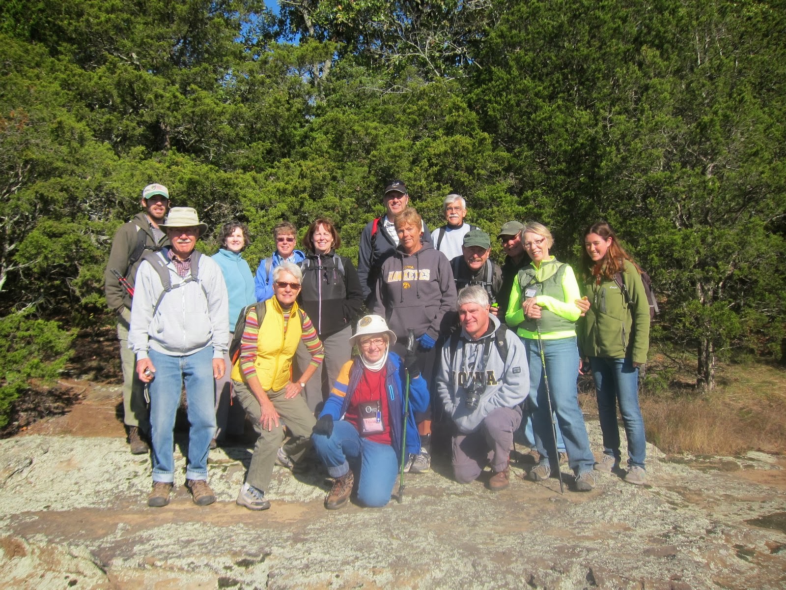
Once we were all on top, we stopped to rest, and take a group photo. The Road Scholar staff from Camp Ondessonk were always very accommodating, when being handed about ten different cameras, to click the shutter on the camera of anyone who wanted the scene captured on their own personal camera. In addition, the staff members were carrying both a video camera, and still camera, to take photos of our adventure, for use as promotional marketing tools for future programs. If I had known I was going to be photographed so much, I would have planned my wardrobe a little better! My only goal had been to have lots of layers, as we were told it would be necessary to dress for temperature changes throughout the day. So, I had lots of layers, but none of them were matching!

After climbing down from the top of the bluffs, we continued our hike around the base. There were many places where the dirt had eroded from beneath the cliff base, to create rock shelters. I can imagine these would have been suitable gathering/living spots for early humans who lived in this area.

And of course, there were more crevices to explore! I followed these guys up into one of the crevices (left photo), and posed for a photo (lower right hand corner), where the opening ended in a very tall and narrow passage, with no way out. After getting reports that the crevice was "somewhat unremarkable", about half of the group waited at the base of the bluff (upper right photo), while we quickly explored the area, and returned to the bottom.

One of the reasons I chose this particular Road Scholar program was because it was held in the Autumn, and I am a "leaf peeper"! I was able to photograph a few of the colored leaves of deciduous trees, but most of them were in the early stages of their color transitions.

After we completed the Round Bluff Trail, we progressed to the Big Rocky Hollow Trail, which is also within Ferne Clyffe State Park. Botanist Chris Benda pointed out this tree, that is still alive---despite having a hole all the way through it, big enough for his arm to pass into, so he could wave his hand on the other side!!

During rainy seasons, there is a waterfall flowing over this bluff. On the day were were there, however, the area was dry, enabling us to thoroughly explore the rock overhang, without getting wet!

There were very tall bluffs on either side of the "waterfall", and several in the party climbed up to a ridge above the falls to explore. I like to get humans in my photos, to help provide a scale of the relative size of the geographic features. I especially like my human beings to give the "uplifted arms victory symbol", to make it easier to spot them in the photo. Both Jean ( on the left ) and Brian ( on the right ), were kind enough to grant my request, as I photographed them from a long distance away. One of my acquaintances that regularly photographs climbers on El Cap at Yosemite, told me it is near impossible to see the climbers, who appear the to be the size of ants, in a long shot of El Cap----unless they have on a brightly-colored tee-shirt! All our group made it down safely from their climbs, and we enjoyed an outdoor lunch (complete with a warm fire in the steel fire pit!), in the picnic area located near the entrance of Big Rocky Hollow Trail. (I was glad this location also had well-maintained women/men's toilets, too!)

From Ferne Clyffe State Park, we drove to hike a section of the River to River Trail. The name refers to a popular trail that goes between the Mississippi River and the Ohio River.

Our group did not hike the entire section of the River to River Trail, as we were headed to explore the Panther Den Wilderness area of the Shawnee National Forest (
www.fs.usda.gov/shawnee ). Botanist Chris Benda explained to us that the designation "Wilderness Area" means no mechanized traffic is allowed (plus a long list of other criteria, that I cannot remember).

The vertical walls of this area were AMAZING!! Our trail co-ordinator "let us loose" to explore on our own, with directions to meet back at the bottom in an hour. Even though I was trying to keep up with the leader, he was soon out of sight, as there were so many "crooks and crannies" to dart into!

Every now and then, I would come out into an opening, and spot some of the group in the distance! I had a whistle on my backpack, so I knew that if I got completely lost, I could make myself heard, if necessary!

One of the Camp Ondessonk (
www.Ondessonk.com ) staff, told us about yet another crevice he would lead anyone through that wanted to try it. He encouraged us to give it a try, saying he had successfully led an 80-year old gentleman through it earlier in the year. I entered the crack, and saw staff member, Johnny, standing at what I thought was the end of the pass-thru. However, what I found out after I got inside so far as to be totally committed to finish, was that Johnny was standing at a space where the rocks made you turn 90 degrees, in order to proceed to the exit.

This second half of the "crevice expedition" is where I encountered my biggest obstacle, and literally got STUCK!! It was only by these guys holding onto the tree outside the exit, and pulling really hard on my arm, that my adipose was able to get sufficiently compressed to make it through! I joked later that I was beginning to think I was going to have to phone a surgeon to give me "emergency liposuction"! Apparently, my dilemma was enough to discourage any of the other women from trying this one!

After getting stuck in the dark crevice, I was ready to see some BLUE SKY, and that is exactly what happened, as our group drove to the Blue Sky Vineyard (
www.blueskyvineyard.com ), to see where our Road Scholar director had married his lovely bride. It was a very picturesque setting, and easy to understand why someone would choose it as a wedding venue!

To help us interpret all the natural flora and fauna we had seen, Chris Benda had visual aides during the evening, to put "written words" with the "spoken words" he had shared during our time together. I was thankful for this follow-up, and in a similar way, I am thankful for the "written words" in the Holy Bible that help us get to know God. I am using this example as a visual aid to help me learn one of my First Place 4 Health (
www.FirstPlace4Health ) memory verses. It says "Let the word of Christ dwell in you richly as you teach and admonish one another with all wisdom..." Colossians 3:16 . Hopefully, these words I have written (with accompanying photos!) have created a spark of interest in exploring the places shown. Simply log on to
www.southernmostillinois.com to start planning your own adventure, or check out
www.RoadScholar.org for a pre-planned experience. Either way, I think you will see it is a place that can give you MILES OF SMILES!! Tricia

 On Wednesday, our Road Scholar group ( www.RoadScholar.org ) explored the Cache River State Natural Area ( www.dnr.state.il.us ). This vast landscape covers 14,328 acres in Johnson and Pulaski counties, of Southern Illinois. There are more than 18 miles of designated foot trails within Cache River State Natural Area, so it was a perfect location for a "walking seminar and field trip" in this distinctive part of Illinois.
 After crossing the trestle bridge shown in the collage above, the hiking trail was beside the Cache River for a distance, before it branched off to provide access to the shallow wetland, called Heron Pond.
  The hiking trail had several Interpretive Panels along the way, which help the visitor to spot significant aspects within their visual field, that they may not be immediately aware of. In addition, our Road Scholar group was fortunate to have botanist Chris Benda in our midst, who was an encyclopedia of knowledge about the habitat we were exploring!
 The cone-shaped objects in this photos are called "knees", and are a prominent feature of the cypress swamp we were traversing. Some of the short ones were "hiding" under leaves along the trail, and almost brought me to MY knees a couple of times, as I stumbled over them!
 During our October visit, the water was covered with a floating carpet of brilliant emerald-colored duckweed. I was reminded of the tiny dots the famous artist Monet used to create his masterpieces in days gone by!
 Our group gathered at the end of the floating boardwalk for a photo, to help us capture this moment in the great outdoors, for future reference and recollection!
 A path called "The Linkage Trail" took us to the Illinois State Champion Cherrybark Oak Tree. Seeing this giant specimen will be a visual aid for me for the Bible verse Jeremiah 17:8, that says "He is like a tree planted by the water, that sends out its roots by the stream, and does not fear when heat comes, and is not anxious in the year of drought, for it does not cease to bear fruit."
  As one peered into the swamp, the little "knees" surrounding their "parent", reminded me of little gremlins, hovering around their mama and papa.!
  The brochure we received on the Nature Reserve called the cypress trees "living pillars", which is illustrated in this photo. The canopy they create high above the swamp is home to bird-voiced tree frogs---which some consider to be the most beautiful of all the frog voices.
  A place within the nature preserve that one should "for sure" visit, is the Cache River Wetlands Center (618-657-2064). Besides having clean (indoor!) restrooms, there is a wildlife viewing area (equipped with binoculars), exhibit area explaining the history of Southernmost Illinois, gift shop, elevated boardwalk over the pond, paved, wheel-chair accessible nature trails, and a connection to the Tunnel Hill Trail, popular with bicyclists. In addition, a staff member is available to answer questions, and help you plan your visit. There is a theater where our group saw a video, with beautiful images and helpful information, about the Cache River State Natural Area. There are also picnic tables, so it was a perfect spot for the hungry Road Scholars to have their picnic lunch, which had been prepared and delivered by the efficient staff at Camp Ondessonk ( www.Ondessonk.com )
 As the name implies, sections of the Tunnel Hill State Trail, are part of the "rails to trails" movement, and we actually saw the tunnel, for which it is named.
 After lunch, our group went by van to the area called Lower Cache River Access point. This is where canoes and kayaks can enter the water to paddle through the Lower Cache River Trail, which varies in length from 3 to 6 miles. The canoe trail enables one to paddle up and touch the state champion bald cypress tree.
 Even though our group was not canoeing, we were still able to see the champion tree from this viewing platform Like many trees within Cache River State Natural Area, it is more than 1,000 years old.
 The fields along the trail leading to the overlook have been reforested, and provided more autumn leaf colors than anyplace else we had visited!
 From the canoe trail, we traveled by van a short distance to the boardwalk at the Section 8 Woods Nature Preserve. This area is popular because it take visitors by the State Champion Water Tupelo tree.
 And human beings were not the only ones along the board walk! This beautiful caterpillar, that looked like a pipe cleaner, was also making its way to the famous tree!
 When the boardwalk ends, you find yourself at the Big Cypress Tree, shown in this collage. It, too, is more than 1000 years old, and has a buttress circumference of more than 40 feet. Folks can go inside it, and the photo on the right of the collage shows that once inside, Chris and Johnny were both able to stand up straight! They positioned themselves inside, so that they could "boost up" anyone who wanted to be photographed with their head sticking through a hole in the tree.
 This collage shows that one of the guys took them up on their challenge, and posed for our cameras. The photos on the left shows that getting your photo taken was the easy part---it was getting OUT of the tree that presented a challenge!
 In this area of Southern Illinois, where east meets west, and north meets south, there are four distinct ecological regions. This unique assemblage of physical attributes, soils, and climate zones, has led to a developing viticulture venture, with nearly fifty wineries involved in grape production. With "agritourism" on the rise throughout the USA, Southern Illinois has become a popular spot on the map. Our group stopped by this "bella terra--beautiful land" venue to freshen up, after our hiking ( www.bellatwinery.com ). You can learn more about the agritourism going on here by visiting www.southernmostillinois.com or phoning 1-800-C-It-Here .
 When we arrived back at Camp Ondessonk, we saw that the staff had been busy all day, preparing for our "foil supper" cookout. There were torches lighting the way through the woods, where we found our dining table, (complete with white tablecloth!) ready for us hungry hikers. The chef had put chicken, beef, or vegetarian entrees in heavy folk wraps, along with vegetables, so that all that had to be done was set them on the hot coals. After the staff had used a food thermometer to assure the ingredients were fully cooked, we chose whichever entrée we wanted, and completed out our dinner plates with baked beans, rolls, condiments, and potatoes. And even though our tummies were full, we gathered around the campfire for the hallowed tradition of making S'MORES!! It was the perfect end to a perfect day, and brought us "MILES OF SMILES"!! Tricia